Mining and Stockpile Measurement
 Mining is one of the highest-paying sectors for drone surveyors. Operations span hundreds of acres, the terrain changes constantly, and ground-based surveying is slow, expensive, and sometimes dangerous. Drones solve all three problems.
Why Mining Needs Drones
A typical mine moves thousands of cubic meters of material every week. Management needs to know how much material has been extracted, how much remains in stockpiles, and whether excavation is proceeding according to plan.
Traditional surveying in mines involves walking stockpiles with GPS rovers, a process that takes hours and risks injury on unstable surfaces. A drone flies the same area in 20 minutes and produces elevation data accurate to a few centimeters.
The value proposition is straightforward: faster data, safer data collection, and more frequent updates. Mining companies that switch to drone surveys typically increase their measurement frequency from monthly to weekly or even daily.
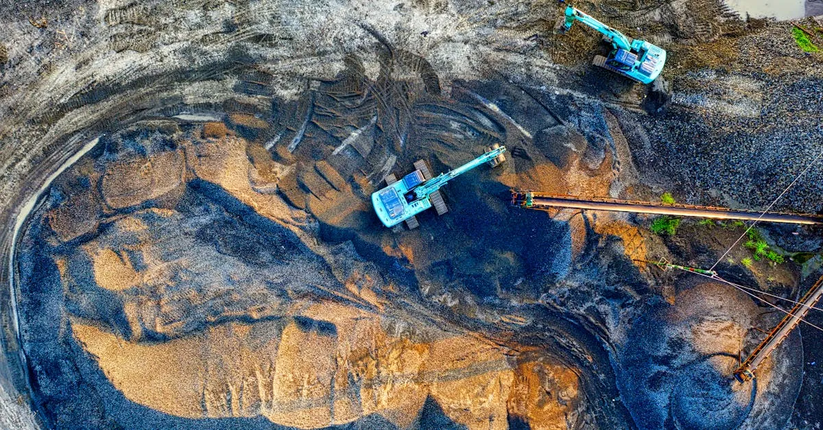
Stockpile Volume Measurement
This is the bread and butter of mining drone work. Stockpiles are mounds of material: coal, gravel, sand, ore, aggregate. The volume of each pile directly affects inventory accounting, financial reporting, and operational planning.
The measurement process works in three steps:
-
Fly the stockyard: Capture overlapping aerial photos of the entire stockpile area from above. Use a grid or double-grid flight pattern at consistent altitude.
-
Generate an elevation model: Photogrammetry software processes the images into a 3D point cloud and digital elevation model (DEM). This gives you the surface shape of every pile.
-
Calculate volumes: The software compares the stockpile surface against a reference plane, either the ground surface beneath the pile or a defined base elevation. The difference between the two surfaces gives you the volume.
Most mapping software (DroneDeploy, Pix4D, Agisoft) includes volume calculation tools. You draw a boundary around the stockpile on the map, and the software computes the volume automatically.
Accuracy Tips
- Place ground control points near stockpiles for centimeter-level accuracy
- Fly at 50-80 meters altitude for dense point clouds over piles
- Capture the ground surface around each pile, not just the pile itself
- Fly during consistent lighting to avoid shadow artifacts in the model
- Re-fly the same areas at the same altitude for comparable measurements over time
Mapping Excavation Progress
Beyond stockpiles, mining companies need regular maps showing how the entire site is changing. Open pits get deeper. Haul roads shift. Waste dumps grow.
By flying the same area at regular intervals (weekly or monthly) and processing each flight into an orthomosaic and DEM, you create a time series that shows exactly what changed and by how much.
Overlay the current map on last month’s map and the differences are immediately visible. You can measure the volume of material removed from a pit, track the expansion of a waste dump, or verify that excavation matches the planned design.
Pricing Mining Work
Mining drone jobs command higher rates than most other sectors because the work is specialized, the sites are remote, and the data requirements are rigorous.
Typical pricing:
- Single stockpile measurement: $200-500 per pile
- Full site survey (mapping + stockpiles): $1,500-5,000 per flight
- Weekly monitoring contract: $3,000-8,000 per month
- Monthly progress reporting: $2,000-4,000 per month
The key to winning mining contracts is reliability. Show up on schedule, deliver consistent quality, and present data in a format their engineers can use immediately.
Equipment for Mining Surveys
A RTK-enabled drone is the minimum for mining work. The DJI Matrice 350 RTK with an RGB camera covers most stockpile and mapping needs. For higher accuracy, pair it with an RTK base station.
Processing software needs to handle large datasets. Mining sites generate thousands of images per flight. Pix4Dmapper and Agisoft Metashape are the industry standards for this volume of data.
Getting Started in Mining
Start by contacting small to mid-size mining operations, aggregate quarries, and sand and gravel pits. These operations often do not have in-house surveying teams and are more open to hiring external drone services than large mining corporations.
Offer a demo flight at a reduced rate. Deliver a stockpile volume report with clear visuals and accurate numbers. One successful demo usually leads to a contract.