Construction Drone Monitoring: Complete Workflow and Pricing
Construction companies need weekly aerial data — progress photos, orthomosaics, and 3D models. Here is the complete workflow, deliverables, and pricing guide.
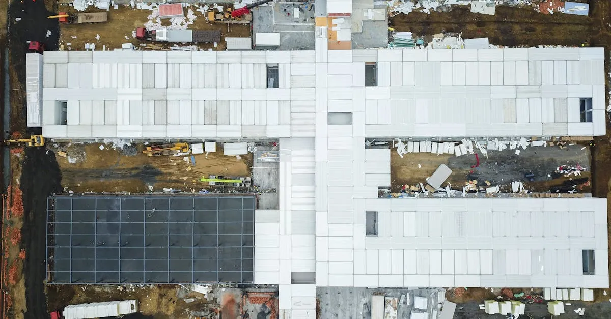
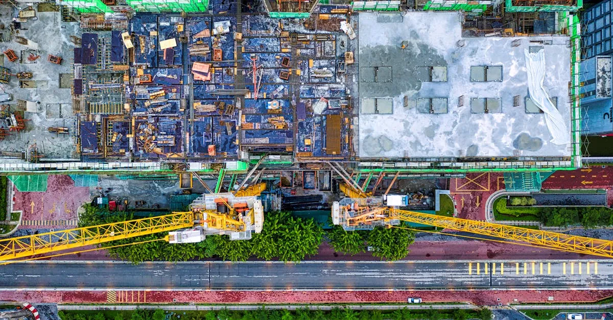
Construction progress documentation might be the most underrated drone service. General contractors need weekly or monthly aerial updates of their job sites, and they pay $150-300 per site visit, with monthly retainers of $600-1,200 for weekly visits. The service spans flight planning, systematic image capture, photogrammetry processing, and delivering orthomosaics, 3D models, and volume calculations.
Construction companies are under pressure to build faster, safer, and cheaper. Drones solve critical pain points: progress tracking, site mapping, safety compliance, dispute resolution, and stakeholder communication. Sending a superintendent up a boom lift to take photos is expensive and dangerous. A drone captures the same information in 20 minutes for a fraction of the cost.
The Workflow
For Progress Documentation
- Fly the same flight pattern on every visit. Consistent angles let stakeholders compare progress across visits.
- Capture overview shots from 4-8 cardinal directions. These show the site in context.
- Get detail shots of active work areas. Close-ups of framing, foundation, roofing, or whatever phase is underway.
- Deliver organized files. Name photos with date and direction (e.g., “2026-09-17_North-Overview.jpg”).
- Create a simple timeline. Side-by-side comparisons of the same angle across visits.
For Advanced Mapping Deliverables
- Pre-flight planning: Define flight path based on site boundaries. Set Ground Sampling Distance (GSD) for adequate resolution. Check airspace and secure LAANC authorization.
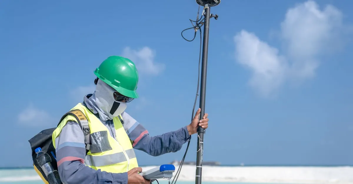
- Data capture: Execute systematic grid flights with 80% front overlap and 70% side overlap. Maintain consistent altitude. Use RTK drone or place Ground Control Points (GCPs) for survey-grade accuracy.
- Data processing: Upload images to photogrammetry software (DroneDeploy, Pix4D, or Agisoft). The software analyzes overlapping photos to build 3D geometry.
- Deliverables: Process raw data into actionable assets.
- Reporting: Compare current map to previous flight. Annotate changes and potential issues. Package for stakeholder distribution.
Types of Deliverables
- Progress photos — Organized by date and direction for timeline comparison
- Orthomosaic maps — Geometrically corrected aerial photo for precise measurements
- Digital Elevation Models (DEM) — Terrain surface for drainage and grading
- 3D point clouds — Import into CAD for engineering analysis
- Cut/fill volume calculations — How much dirt to remove or bring in
- Progress overlays — Side-by-side comparisons of current vs previous
- 360° panoramas — Immersive stakeholder views
- Thermal scans — Moisture intrusion, missing insulation, electrical hotspots
Equipment
Basic progress photos: A standard GPS drone with a 4K camera handles this completely. No thermal cameras, mapping software, or special sensors required. The value is reliability and consistency.
Advanced mapping: DJI Mavic 3 Enterprise for most sites, DJI Matrice for heavy payloads. Software: DroneDeploy (easiest), Pix4D (powerful, engineer-accepted), Agisoft (professional photogrammetry).
Flight Cadence
- Active phases (earthwork): Weekly
- Slower phases (framing): Biweekly
- Long-term projects: Monthly
- Major milestones: Before and after
Pricing
| Structure | Range |
|---|---|
| Per-visit (basic photos) | $150-300 |
| Per-visit (mapping deliverables) | $300-800 |
| Monthly retainer (weekly visits) | $600-1,200 (photos) / $1,500-4,000 (mapping) |
| Multi-site (3+ locations) | $100-200 per site |
| Project-long contract | $10,000-50,000+ |
A single construction project can generate 10-20 site visits over six months. At $200 per visit, one project is worth $2,000-4,000 in total revenue. Land three concurrent projects and you have a solid income foundation.
Landing Construction Clients
Research local general contractors through LinkedIn or your city’s building permit database. Find projects that recently broke ground and reach out to the project manager with a sample progress report. One successful demo usually leads to a contract.
Construction progress photos are not about artistry. They are about reliability and consistency. Show up on schedule, fly the same angles, deliver the files promptly, and you will keep the contract for the entire project duration.
Frequently Asked Questions
What ground sampling distance should I use? Most construction applications work well with 1-3 cm GSD, balancing detail with practical flight and processing requirements. Higher resolution provides more detail but increases processing time.
How do ground control points improve mapping accuracy? GCPs are physical markers with known coordinates that photogrammetry software uses to georeference your model. They achieve survey-grade accuracy of 1-2 cm compared to 3-5 cm without them.
Why is 80% front overlap and 70% side overlap recommended? This overlap ensures enough common points between images for accurate 3D reconstruction. Less overlap causes gaps or poor model quality, while more increases flight time without significant accuracy gains.
How do cut/fill calculations help construction projects? These compare current terrain against design grades to determine how much material needs removing or adding. This helps contractors optimize earthwork operations and avoid expensive surprises during grading.
Should I offer multi-site discounts? Yes. General contractors managing multiple projects often need documentation at several locations. Offer reduced per-site rate of $100-200 for three or more sites.
How do I find clients? Research local general contractors through LinkedIn or your city’s building permit database. Find recently started projects and reach out to project managers with a sample progress report.
Learn the complete photogrammetry pipeline in our free Drone Mapping course. For more business strategies, see our free Drone Business course.