Drone Surveying vs Mapping: What's the Difference
Surveying is measurement-focused. Mapping is visual representation-focused. They overlap but serve different purposes — here's exactly where the line is drawn.
Drone surveying focuses on precision measurements like distances, elevations, volumes, and boundaries, requiring centimeter-level accuracy and often a licensed surveyor. Drone mapping creates visual representations like orthomosaics and 3D models from aerial imagery, with less stringent accuracy needs and no licensing requirements.
The Short Answer
Surveying = measurement-focused (distances, elevations, volumes, boundaries). Precision data for engineering and legal purposes.
Mapping = visual representation-focused (orthomosaics, 3D models, land cover, NDVI). Creating usable digital models of real-world spaces.
They use the same equipment but serve different end goals.
What Is Drone Surveying?
Precision measurement of the earth’s surface. Clients care about raw, accurate data — not pretty pictures.
Accuracy requirements are stringent: centimeter-level with RTK drones or Ground Control Points.
Outputs: Topographic data, volume calculations, elevation profiles, boundary lines.
In many states, a licensed land surveyor must sign off on boundary surveys. You cannot legally declare property boundaries without a surveying license.
What Is Drone Mapping?
Creating visual representations of terrain from overlapping aerial imagery and photogrammetry software. Less stringent accuracy requirements.
Outputs: Orthomosaic maps, 3D textured models, NDVI maps (agriculture), thermal maps.
Anyone with a drone and photogrammetry software can create maps. No special license required for mapping deliverables.
Where They Overlap
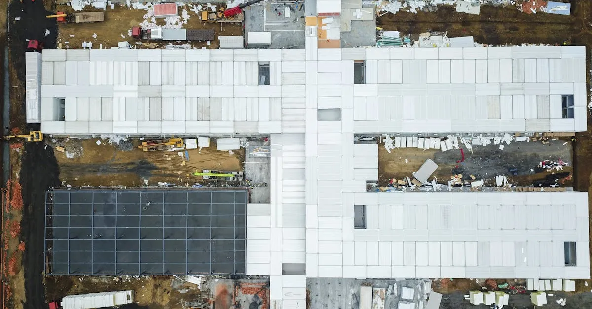
Both use the same equipment: drone + camera + photogrammetry software. Both require systematic flight planning with proper overlap (70-80% front and side). The construction industry uses both simultaneously — one flight can produce mapping deliverables for marketing AND surveying deliverables for engineering.
Modern RTK drones blur the line further by delivering survey-grade accuracy from what looks like a standard mapping workflow.
Which Do You Need?
| Question | Answer |
|---|---|
| Exact elevations and distances? | Surveying |
| Visual map or 3D model? | Mapping |
| Calculate dirt to move? | Surveying |
| Show investors the site? | Mapping |
| Monitor crop health? | Mapping (NDVI) |
Legal Considerations
Only licensed land surveyors can certify boundary surveys, subdivision plats, or topographic surveys for engineering design.
Drone operators without surveying licenses can perform mapping, volumetrics, and inspection — but not legal boundary determinations. You can show where a fence sits, but labeling it as a “legal property line” crosses into licensed territory.
Always check your state’s requirements before offering measurement-based services.
Frequently Asked Questions
What accuracy level does drone surveying require? Centimeter-level accuracy, typically achieved through RTK-enabled drones or Ground Control Points. This precision is essential for engineering and legal applications.
Can anyone create drone maps without special certification? Yes. Anyone with a drone and photogrammetry software can produce mapping deliverables like orthomosaics and 3D models. No surveying license is required for visual outputs.
What outputs does drone mapping typically produce? Orthomosaic maps, 3D textured models, NDVI maps for agriculture, and thermal maps. These are visual representations rather than raw measurement data.
Do both disciplines use the same equipment? Yes. Both use a drone, camera, and photogrammetry software, and both require systematic flight planning with 70-80% front and side overlap.
When would I need surveying instead of mapping? Choose surveying when you need exact elevations, distances, volume calculations, or legal boundary determinations. Mapping suits visual presentations, investor tours, or crop health monitoring.
What legal restrictions apply to drone surveying? Only licensed land surveyors can certify boundary surveys, subdivision plats, or topographic surveys for engineering design. Unlicensed operators can perform mapping but cannot make legal property line determinations. Learn both disciplines in our free courses: Drone Mapping for visual deliverables, Drone Surveying Business for precision measurement workflows.